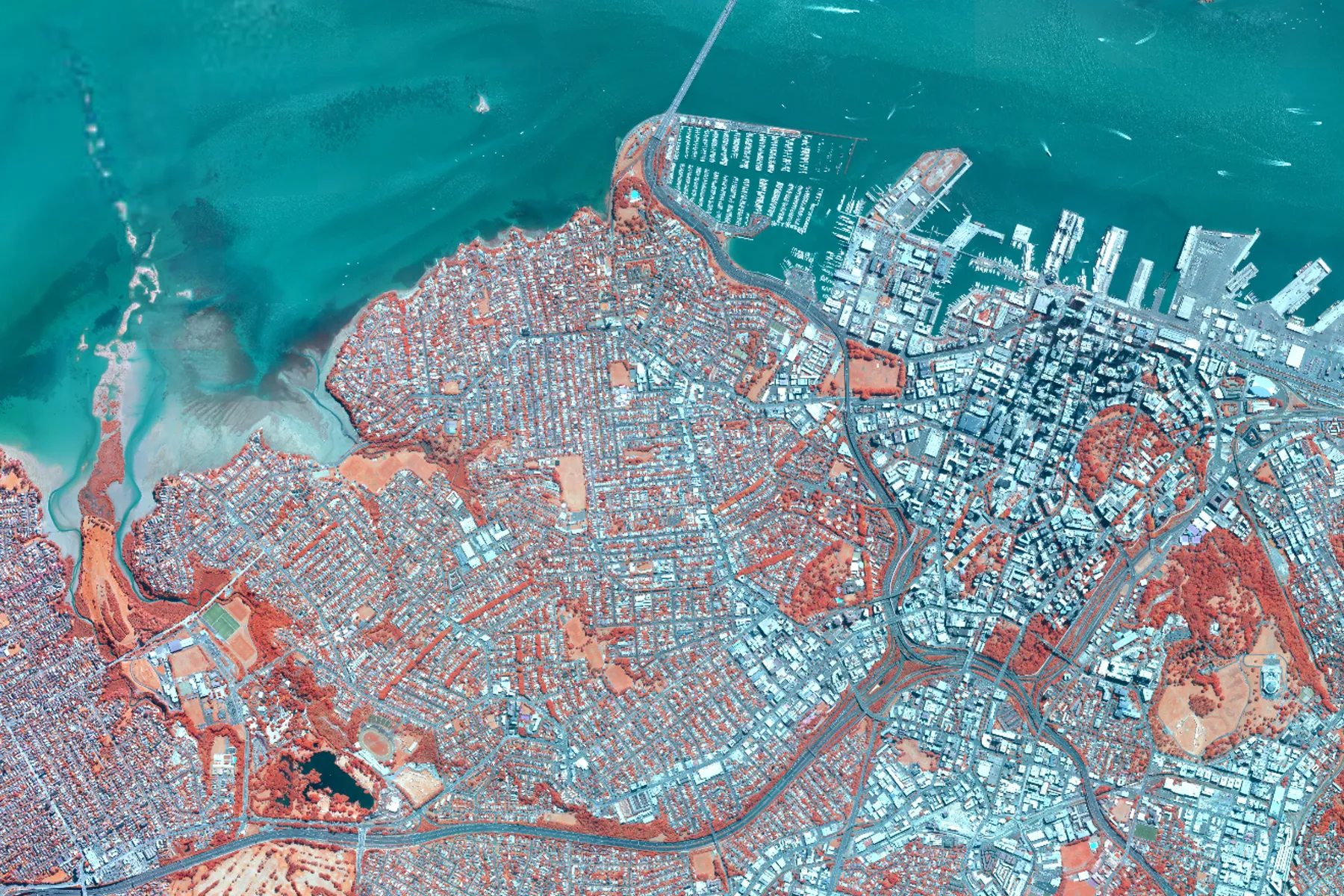
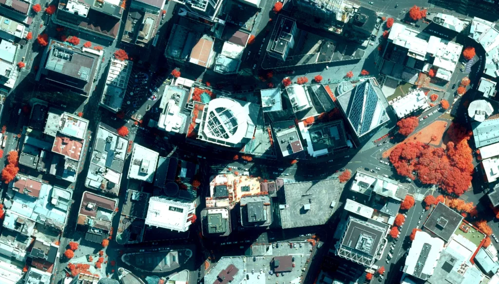
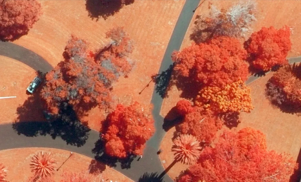
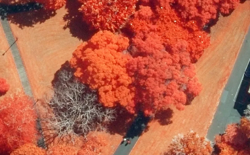
Auckland Council has released a new dataset featuring high-resolution colour infrared (CIR) aerial imagery of the Auckland region, captured in 2024 and 2025. Available via Auckland Council’s Open Data portal, this imagery offers a unique lens for observing Tāmaki Makaurau’s landscape – especially when it comes to analysing vegetation, water bodies, soil conditions, and built environments. The coverage will be updated in the following months to cover the entire region.
Unlike traditional aerial photography, colour infrared imagery uses sensors that detect near-infrared light. These wavelengths are invisible to the human eye but provide important insights to understanding the health and structure of our environment. In this imagery:
- Healthy vegetation appears in shades of red and pink, with brighter tones indicating more vigorous growth and chlorophyll production.
- Water appears in deep blues and blacks, helping to identify turbidity, sediment levels, or submerged features.
- Bare soil appears in white, blue or green depending on moisture content and composition. Darker shades often indicate moister soil.
- Urban features such as roads, buildings, and infrastructure appear in shades of cyan and blue-green, standing out clearly against natural elements.
Whether you’re monitoring forest health, planning urban greening, studying coastal change, or supporting precision agriculture, this dataset opens up new opportunities for analysis and decision making.
Access the datasets here:
- Auckland Infrared Imagery 2024 – 2025 | Auckland Council Open Data
- West Auckland Infrared Imagery 2024 | Auckland Council Open Data
For more information contact: dragos.bratasanu@aucklandcouncil.govt.nz